Doi Inthanon by Scooter
Thailand's roof. A 210km round-trip to 2,565m—waterfalls and twin royal pagodas.
Why choose this route
Doi Inthanon is not a casual errand—it’s a full commitment day that rewards the disciplined. It offers the most dramatic scale of any ride in the region: thunderous waterfalls, high-altitude royal gardens, and the literal roof of Thailand at 2,565 metres.
It’s for the rider who wants a milestone day and appreciates the cool, thin air that only the summit can provide.
Route Briefing
The ride is roughly 210km round trip. It’s the most demanding route in the set due to the sustained elevation changes and the high mileage. A Touring 300 scooter is strongly preferred for stability and comfort on the long climbs and descents. Do not attempt this as your first ride in Chiang Mai; save it for when your mountain focus is sharp.
Route Snapshot
Fundamental data to help you size up the ride before you start the engine.
A major full-day ride with highway distance, mountain climbing, and national park pacing.
A serious round trip; the longest single-day route in our guide.
Needs a very early start; the distance and park stops take 8-10 hours.
The challenge comes from distance, cooler weather, and total rider fatigue.
Suits riders who want one of the biggest and most memorable ride days.
Earlier starts give more time inside the park and a less rushed return.
The best choice for sustained climbs where comfort and power matter most.
Multiple major stops inside the park, with the climb serving as the approach.
Riders handle the mountain fine, but the total day length is what wears people down.
Route Highlights
Power Stop
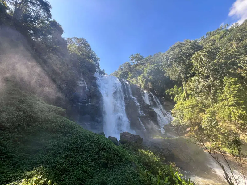
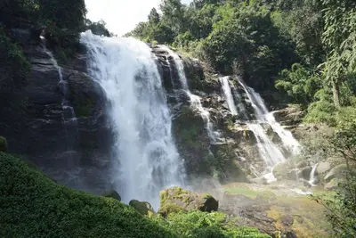
Wachirathan Waterfall
A massive cascade right off the main road. Powerful spray cools the area. Strong first stop to break up the highway run.

Local Stop
Hmong Community Market
High-altitude market selling mountain produce, strawberries, and hill-tribe crafts. A natural midpoint break.

Royal Landmark
Twin Royal Pagodas
Phra Mahathat Naphamethanidon and Naphapholphumisiri. Stunning gardens and panoramic views near the summit. Dress code applies.
Highest Point
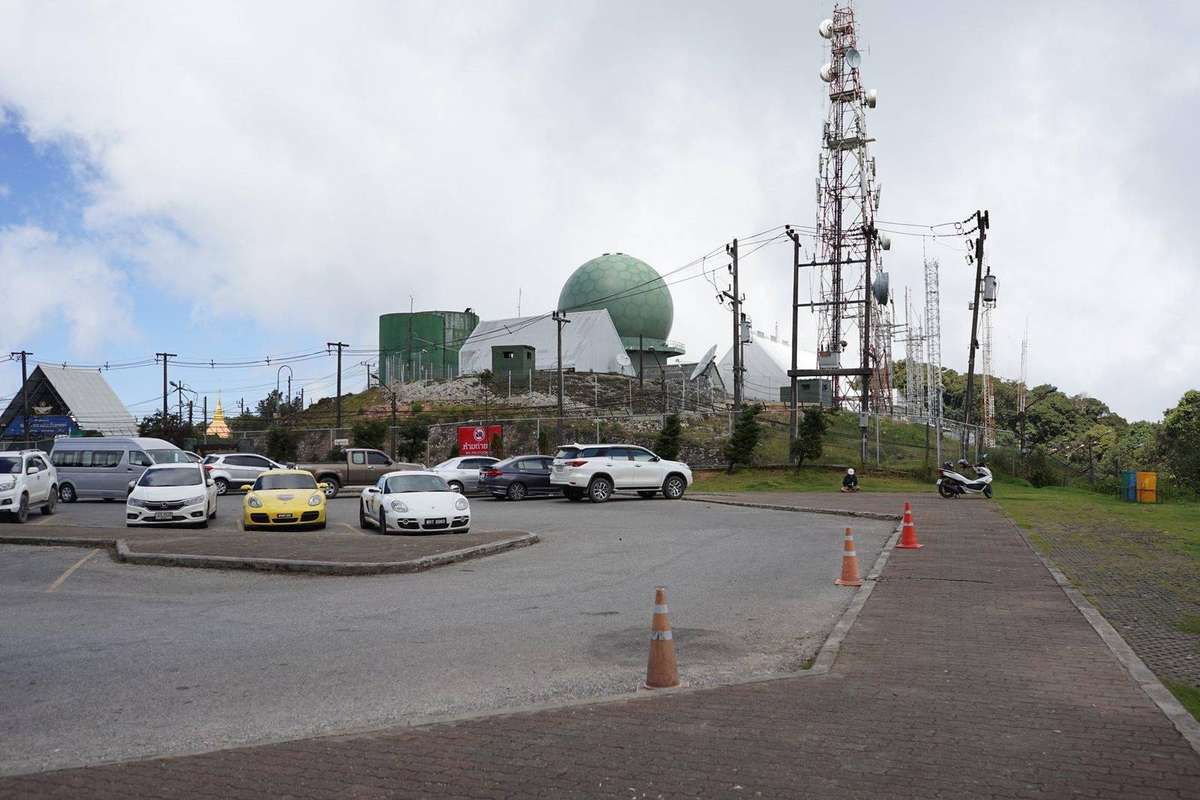
Doi Inthanon Summit
The highest point in Thailand at 2,565 metres. Cool, misty cloud forest walk. Open 04:00–17:00.
Before You Go
- Departure (6 AM): Start very early to reach the summit before the tour groups arrive around 10 AM. This also gives you a full day for the 210km round trip without rushing.
- Temperature shift: Expect 10–15°C colder at the summit than in Chiang Mai. Even in the hot season, a windproof layer is essential—altitude and 60km/h wind chill will catch you off guard.
- Brake management on descent: Do not ride your brakes on the long descent. Use short, firm bursts to kill speed, then release to cool. If brakes feel spongy, pull over at one of the waterfall turn-offs and wait 15 minutes.
- Hydration: Altitude and wind dehydrate faster than you realise. Keep water within reach throughout the day.
- Park fees: Confirm current rates on arrival (~300 THB foreign / ~100 THB Thai). Twin Pagodas have a separate entry fee (~100 THB/person).
Segment-by-Segment
Chiang Mai → Chom Thong (Route 108 / 15)
Highway run, well-paved and wide. Straightforward and fast—use this leg to settle into the ride. Main hazards are long-haul trucks and morning traffic heading to market.
Chom Thong → Doi Inthanon Park Gate
Mountain road begins here—roughly 30 km of climbing. The road is well-maintained but steep in sections. Views start opening up. Take your time; this is the warm-up for the real elevation ahead.
Inside the Park (Gate → Waterfall → Pagodas → Summit)
Well-maintained national park road. Two route options: Route 1013 (more scenic) or Route 1009 (faster). The road is steep in places, winding, and the temperature drops as you gain elevation. Pace yourself—save energy for the summit and the long return leg.
What riders report
Two routes in (Reddit r/ThailandTourism, 2025)
“There are two routes that will take you where you want to go, 1013 or 1009. The former is the more scenic route but the latter is the quicker.” Most riders report taking Route 1013 for the views on the way up, though both are in good condition.
— Reddit user, From Chiang Mai to Doi Inthanon by motorbike, reddit.com/r/ThailandTourism (accessed 2026-04-27)
The park experience (The Blond Travels, 2024)
“Doi Inthanon is one of the most varied and scenic national parks in Thailand and it’s just a couple of hours from Chiang Mai. You’ll find Thailand’s highest peak, misty cloud forests, tiered waterfalls and the iconic King and Queen Pagodas perched above the valley.”
— The Blond Travels, Doi Inthanon: Road Trip to Thailand’s Highest Mountain, theblondtravels.com (accessed 2026-04-27)
Day trip feasibility (In Wanderment, 2024)
“If you’re pressed for time, staying in Chiang Mai and doing Doi Inthanon as a one-day trip is still totally doable especially if you’ve got private transport or a tour booked.” The blogger notes the park is “one of the most rewarding day trips from Chiang Mai.”
— In Wanderment, How To Get From Chiang Mai To Doi Inthanon National Park, inwanderment.com (accessed 2026-04-27)
Local knowledge & road feel
The Distance Warning
Inthanon is more demanding than the Samoeng Loop because the scale is bigger. The 100km ride back from the summit can feel long if you haven’t paced your energy. Keep your hydration high—altitude and wind can dehydrate you faster than you realize.Brake Control & Descending
The descent from 2,500m is not technical, but it’s sustained. Do not ride your brakes. Use short, firm bursts to kill speed and then release to let them cool. If you feel your brakes getting spongy, pull over immediately at one of the waterfall turn-offs and wait 15 minutes.The Temperature Shift
Expect a 10-15°C temperature drop between Chiang Mai and the summit. November mornings can see temperatures as low as 5°C. Even in the hot season, the wind at 60km/h and 2,500m elevation makes a windproof layer essential for comfort and safety.By Kai Mercer · Updated April 2026